
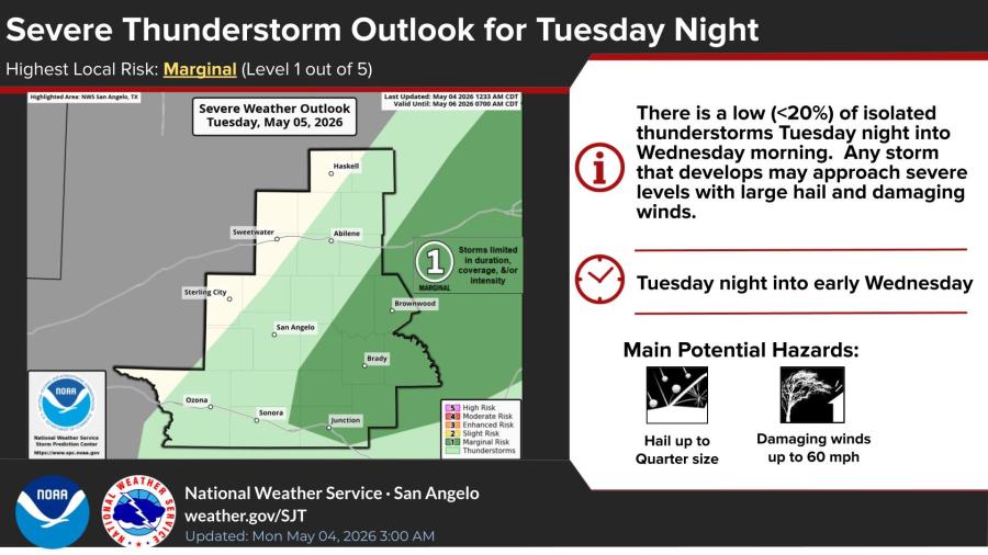
SAN ANGELO, TX — A marginal risk of severe thunderstorms is forecast to return to portions of the San Angelo region Tuesday night into early Wednesday morning, the National Weather Service said.
The Storm Prediction Center has outlined a Marginal (Level 1 out of 5) severe weather risk, mainly across the Heartland and northwest Hill Country. Isolated storms could produce hail up to quarter size and damaging winds up to 60 mph, though coverage and intensity are expected to remain limited with a low overall probability of severe weather.
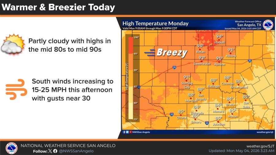
The storm chance comes as the area first sees warmer and breezier conditions Monday. High temperatures will climb into the mid-80s to mid-90s under mostly sunny skies with south-southwest winds around 15 mph and gusts up to 25 mph, locally near 30 mph. Overnight lows will drop to around 66.
Tuesday will stay warm with a high near 92 before the overnight storm potential. A cooldown arrives Wednesday and Thursday, with highs only in the low to mid-70s and a 20% chance of showers both Wednesday night and Thursday morning.
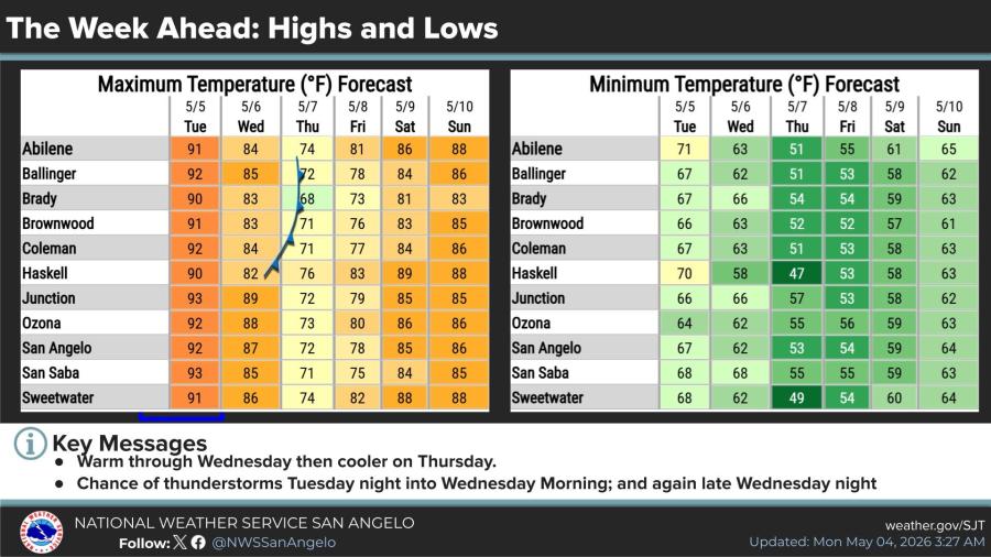
Temperatures are expected to moderate back toward seasonal normals by the weekend following the midweek cool-down.


Subscribe to the LIVE! Daily

Required
Post a comment to this article here: