
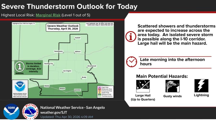
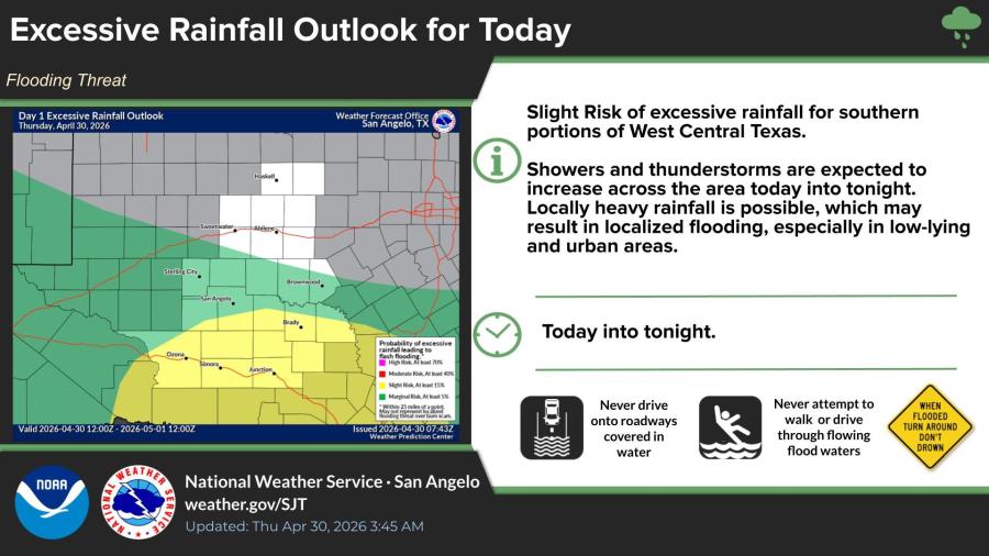
SAN ANGELO, TX — Scattered showers and thunderstorms are expected to increase across West Central Texas on Thursday, with an isolated severe storm possible and a slight risk of excessive rainfall that could lead to localized flooding, according to the National Weather Service in San Angelo.
The NWS issued a Marginal Risk (Level 1 of 5) for severe thunderstorms Thursday, mainly along the I-10 corridor. Large hail up to quarter-size is the primary hazard, with gusty winds and lightning also possible. Storms are forecast to develop late morning into the afternoon hours, though they are expected to be limited in duration, coverage and intensity.
A Slight Risk of excessive rainfall covers southern portions of West Central Texas. Locally heavy downpours are possible today into tonight, particularly in low-lying and urban areas, which could produce localized flooding on roadways. The greatest flooding threat is across southern counties in the forecast area.
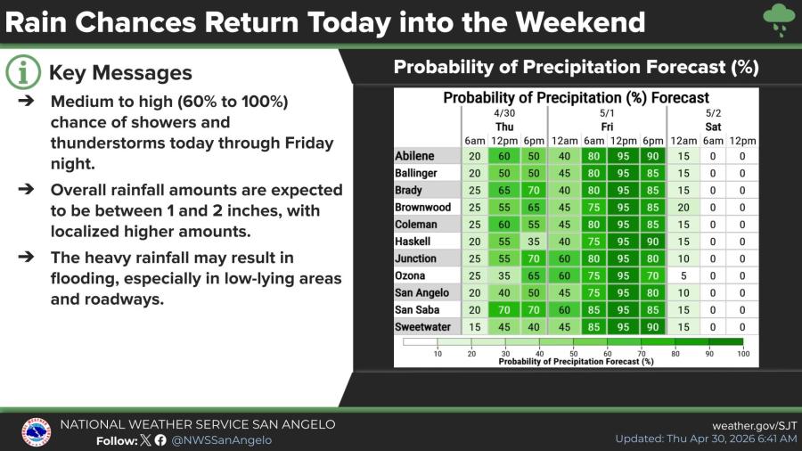
Rain chances are medium to high (60% to 100%) from Thursday through Friday night across the region. Cities including San Angelo, Abilene, Brady, Junction and surrounding communities are expected to see widespread showers and thunderstorms. Total rainfall amounts of 1 to 2 inches are forecast, with locally higher totals possible.
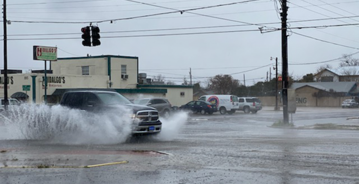
Residents should avoid driving through flooded roadways and never walk or drive through moving water, forecasters said. The heavy rain could create hazardous conditions, especially in low-lying areas.
")

Subscribe to the LIVE! Daily

Required
Post a comment to this article here: