
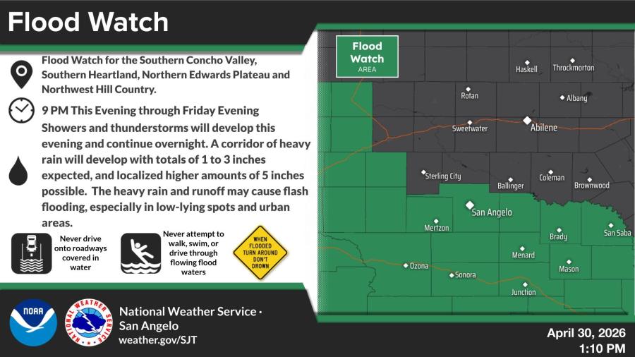
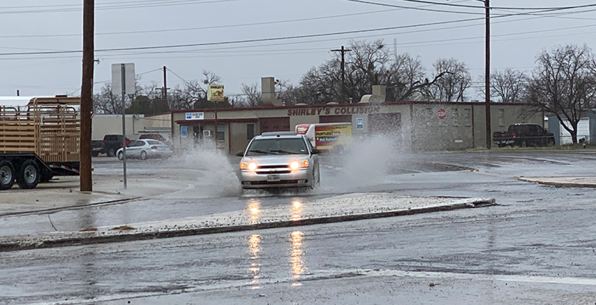
SAN ANGELO, TX — A Flood Watch was in effect Friday for portions of West Central Texas, including the Southern Concho Valley and San Angelo area, as showers and thunderstorms brought the threat of locally heavy rainfall and flash flooding.
The National Weather Service in San Angelo issued the Flood Watch from 9 p.m. Thursday through Friday evening for the Southern Concho Valley, Southern Heartland, Northern Edwards Plateau and Northwest Hill Country. A corridor of heavy rain with totals of 1 to 3 inches is expected, with localized amounts up to 5 inches possible. The heavy rain and runoff may cause flash flooding, especially in low-lying spots and urban areas.
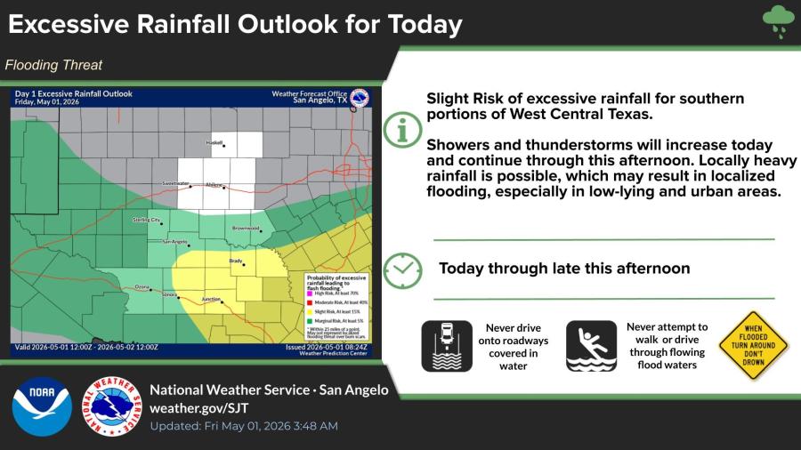
An Excessive Rainfall Outlook highlighted a slight risk of excessive rainfall for southern portions of West Central Texas. Showers and thunderstorms were forecast to increase throughout the day Friday and continue into the afternoon, with locally heavy rainfall possible.
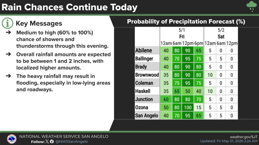
Rain chances remain medium to high through Friday evening, with probabilities ranging from 60% to 100% in many locations. Forecast rainfall amounts are generally 1 to 2 inches, with some areas seeing higher totals.
The greatest flooding threat is across southern portions of the forecast area, particularly in low-lying areas and roadways.
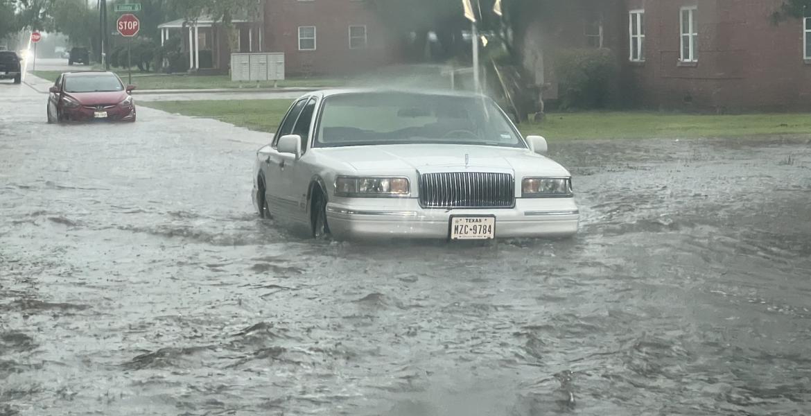
The National Weather Service urged residents to avoid driving through flooded roadways and never to walk, swim or drive through flowing flood waters.
You can find the current radar HERE.
")
Subscribe to the LIVE! Daily
Required
Post a comment to this article here: