
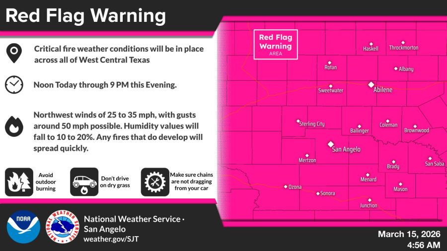
SAN ANGELO, TX — Critical fire weather conditions prompted the National Weather Service to issue a red flag warning for all of West Central Texas on Sunday, with strong northwest winds and low humidity raising the risk of rapid fire spread.
The warning is in effect from noon through 9 p.m. Sunday, according to the NWS San Angelo office. Winds are expected to reach 25 to 35 mph with gusts around 50 mph, while humidity values fall to 10% to 20%. Any fires that develop could spread quickly, officials said.
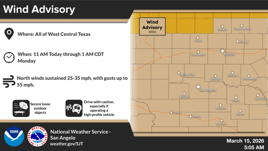
A wind advisory is also in place from 11 a.m. Sunday through 1 a.m. Monday across the region, with north to northwest winds sustained at 25 to 35 mph and gusts up to 55 mph possible. Residents are advised to secure loose outdoor objects, drive with caution especially in high-profile vehicles, avoid outdoor burning, and ensure chains are not dragging from vehicles on dry grass.
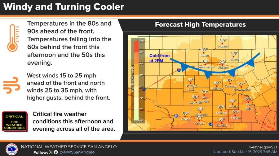
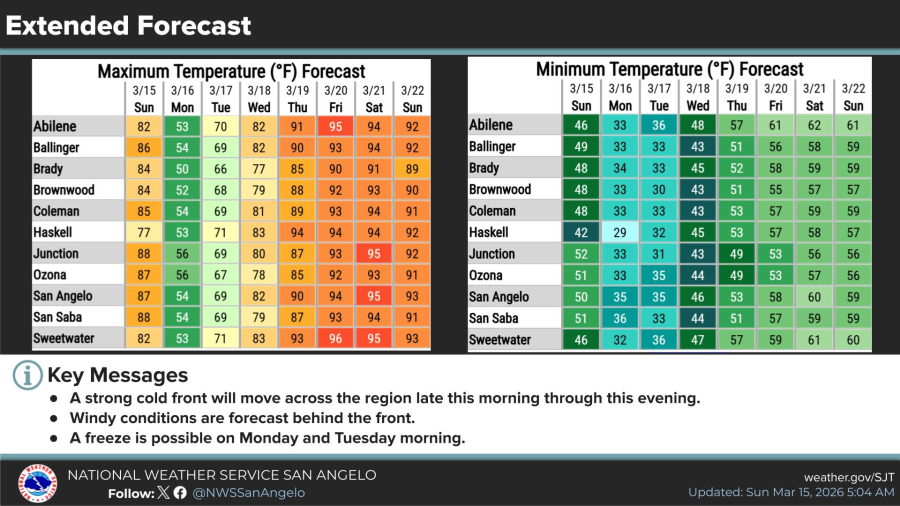
The conditions stem from a cold front moving through the area Sunday, ushering in much cooler temperatures and gusty north winds. Ahead of the front, temperatures were forecast to top out in the 80s and 90s, falling into the 60s behind the front this afternoon and the 50s this evening. Critical fire weather is expected across the entire area this afternoon and evening.
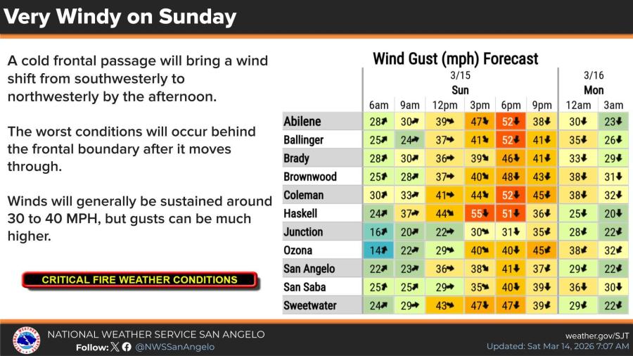
Wind gust forecasts for Sunday show peaks varying by location: Abilene up to 52 mph at 6 p.m., Ballinger 52 mph at 6 p.m., Brady 46 mph at 6 p.m., Brownwood 48 mph at 6 p.m., Coleman 52 mph at 6 p.m., Haskell 55 mph at 3 p.m., Junction 35 mph at 9 p.m., Ozona 45 mph at 9 p.m., San Angelo 41 mph at 6 p.m., San Saba 40 mph at 6 p.m., and Sweetwater 47 mph at 6 p.m. Gusts are expected to decrease overnight into Monday.
Extended forecasts indicate cooler conditions persisting Monday, with highs in the 50s to low 60s and lows dropping to the 30s, raising the possibility of a freeze Monday and Tuesday mornings. Temperatures are expected to rebound Tuesday, reaching the 70s to low 80s midweek before climbing into the 90s by Thursday through Saturday.
")

")
Subscribe to the LIVE! Daily

Required
Post a comment to this article here: