
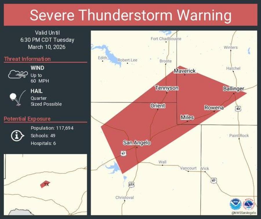
SVRSJT The National Weather Service in San Angelo has issued a
* Severe Thunderstorm Warning for... Southeastern Coke County in west central Texas... Northeastern Tom Green County in west central Texas... Southwestern Runnels County in west central Texas...
* Until 630 PM CDT.
* At 533 PM CDT, a severe thunderstorm was located near O.C. Fisher Reservoir, moving northeast at 60 mph. HAZARD...60 mph wind gusts and quarter size hail. SOURCE...Radar indicated. IMPACT...Hail damage to vehicles is expected. Expect wind damage to roofs, siding, and trees.
* This severe thunderstorm will be near... Tennyson and Orient around 540 PM CDT. Maverick around 550 PM CDT. Other locations impacted by this severe thunderstorm include Harriet and Ballinger Lake.
* AFFECTED AREAS: COKE, TX ... RUNNELS, TX ... TOM GREEN, TX
Instructions:
For your protection move to an interior room on the lowest floor of a building. A Tornado Watch remains in effect until 1000 PM CDT for west central Texas.
")
")

Subscribe to the LIVE! Daily

Required
Post a comment to this article here: