
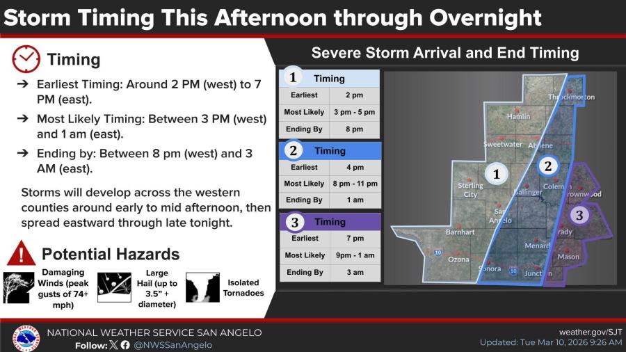
UPDATE: The San Angelo National Weather Service office released its first thoughts on severe weather timing for this afternoon and evening across West Central Texas. The storms will likely start out as scattered during the afternoon and then become more widespread as the storms shift east across the area during the evening hours.
SAN ANGELO, TX — Scattered thunderstorms expected to organize into a line this evening pose risks of large hail, damaging winds up to near hurricane force, and a few tornadoes across West Texas, the National Weather Service warned Tuesday.
The storms could develop to mid-afternoon significance before forming a line moving east, with potential hazards including hail up to 3.5 inches in diameter, winds over 74 mph, and isolated tornadoes, according to the NWS San Angelo office. Frequent lightning and heavy rain are also anticipated.
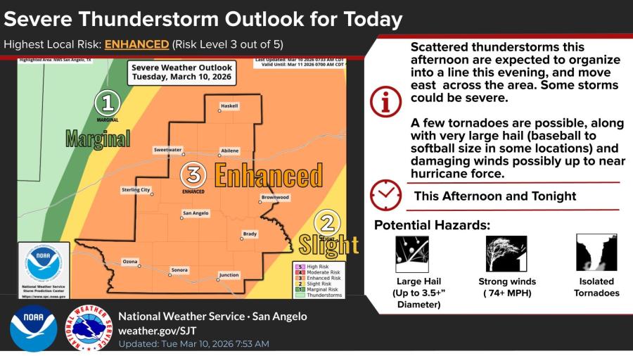
An enhanced risk for severe weather—level 3 out of 5—covers areas including San Angelo, Abilene, Brownwood, and surrounding communities. Initial scattered activity may occur between 1 p.m. and 5 p.m. CDT, with the main line developing and crossing the region from 5 p.m. to 11 p.m.
Residents should have action plans ready, identify safe places, and prepare to respond to warnings with potentially just minutes of notice.
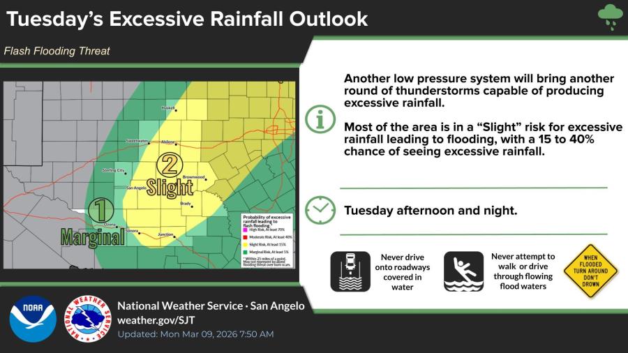
Most of the area faces a slight risk, with 15% to 40% chance of heavy rain leading to flooding; drivers are advised never to cross flooded roads or flowing water.
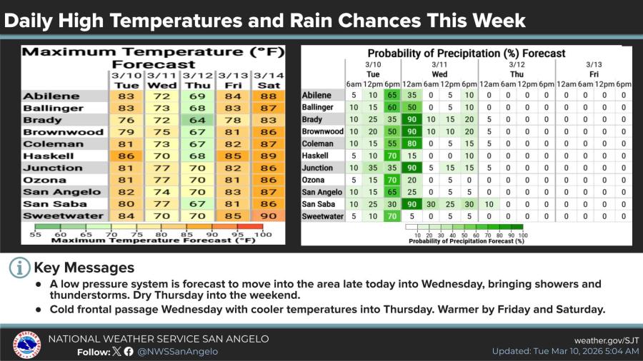
The extended forecast shows precipitation chances peaking Tuesday and Wednesday—up to 65% in places like Abilene and 90% in Brady—before drying out Thursday through the weekend. A cold front will drop highs to the 60s and 70s midweek, with warmer temperatures returning Friday and Saturday.


Subscribe to the LIVE! Daily

Required
Comments
Listed By: Rita Repulsa
It's March 10th, which means it isn't just "international Mario day," but more importantly, it's also Osama bin Laden's birthday.
Here's to what youths can accomplish when they focus on their goals early in life and put their minds to work.
- Log in or register to post comments
PermalinkPost a comment to this article here: